HD Satellite Map
NASA high-definition satellite images. Updated every day since the year 2000.

Measure Distance
Measure area.
Click on the map to add points. Double‑click to finish.
Tap on the map to add points.

Eyach-Runde

Nur teilweise gewandert, sehr schön an der Eyach entlang. ...
Eine idyllische Rundwanderung mit dem Wasserwegle entlang der plätschernden Eyach als Highlight der Tour.
Es besteht die Wahlmöglichkeit zwischen 3 Tour-Varianten, weil mehrerer Wege von der Eyachmühle zum Lehmanshof führen.
Variante 1: Eyachmühle - auf dem "Dobler Sträßle" (auch "Dobel-Wildbad-Sträßle") über die Brücke auf die rechte Eyachseite - immer auf dem Weg am unteren Talhang bleiben ( nicht auf die links abbiegenden Wege wie "Pfeiffersweg", "Schaiblesweg" einschwenken) - "Hirschbrunnen" - "Lehmannshof". Zurück auf dem sogenannten "Wasserweg", der unmittelbar am Bach verläuft. Weiter über die Behelfsbrücke oberhalb der kleinen Staustufe der Mannenbach-Wasserversorgung zum geteerten Eyachtalsträßchen bis zum Ausgangspunkt Eyachmühle.
Variante 2: Eyachmühle - auf dem geteerten Eyachtalsträßchen bis zum Seerosenteich, vorbei am "Paul-Ochner-Brunnen", bis zum Lehmannshof. Zurück wie Variante 1.
Autorentipp
Einkehr im Gasthaus "Eyachmühle" (Tal) oder in den Restaurants im Hauptort Dobel (Höhe).

Sicherheitshinweise
Die Passage Wasserweg ist etwa 2,5 km lang und verläuft größtenteils unmittelbat am Ufer der Eyach. Einige Stellen sind unwegsam, zeitweise schlammig oder stehen unter Wasser. Körperliche Fitness und gutes Schuhwerk sind unbedingt erforderlich.
Die Wanderung verläuft gänzlich auf Flächen, die als Naturschutz-, Landschafts- und Vogelschutzgebiete ausgewiesen sind. Die entsprechenden Hinweise und Regeln sind unbedingt einzuhalten.
Die wichtigsten Regeln
- die Wege nicht verlassen (Trittbelastungen schädigen die Vegetation, seltene Pflanzen sterben ab. Typische Vogelarten werden vertrieben, begonnene Bruten verlassen.)
- Hunde nicht frei laufen lassen (Brütende oder nahrungssuchende Tiere werden vertrieben.)
- Pflanzen nicht entnehmen oder beschädigen (Jedes Pflücken oder Ausgraben beschleunigt das Aussterben gefährdeter Arten.)
- Tiere nicht beunruhigen, fangen oder verletzen (Im Naturschutzgebiet soll eine ungestörte Entwicklung von Tieren möglich sein.)
- kein Feuer machen (Pflanzen und Kleintiere verbrennen, brütende Tierarten werden vertrieben.)
- keine Abfälle oder anderes Material lagern oder wegwerfen (Biotope werden dadurch zerstört.)
- nicht reiten (Durch den Hufschlag wird die Vegetation geschädigt und Tiere werden vertrieben.)
- keinen Lärm verursachen oder Tiere beunruhigen (Vor allem die scheuen und deshalb in ihrer Existenz bedrohten Tiere verlassen das Biotop und verlieren damit ihren Lebensraum.)
Weitere Infos und Links
Kulinarische Stärkung und To-Go-Angebote findest du im Restaurant Eyachbrücke .
Wegbeschreibung
Variante 1: Vom Parkplatz beim Gasthaus "Eyachmühle" geht es zunächst über die Brücke auf dem sogenannten "Dobler Sträßle" (auch "Dobel-Wildbad-Sträßle") mäßig aufwärts. In der Haarnadelkurve verlassen wir das Sträßchen und gehen geradeaus, immer unterhalb des vom Orkan "Lothar" stark heimgesuchten "Tiefengrunds" und "Nasskittelbergs". Wir passieren den Abzweig des "Schaibleswegs" und im weiteren Verlauf auch den "Hirschbrunnen" und erreichen mit einem kleinen Abstieg den ehemaligen "Lehmannshof" mit Schutzhütte und Grillplatz.
Der Rückweg zur Eyachmühle führt vom Grillplatz zunächst über Wiese auf der dort befindlichen "Birken-Allee". Im Anschluss daran beginnt der etwas anspruchsvolle Pfad entlang der Eyach, der sogenannte "Wasserweg". Anspruchsvoll deshalb, weil zum Teil quer zu Pfadrichtung verlaufende kleiner Bäche für "tiefen Boden" sorgen und oft Felsbrocken überstiegen oder umgangen werden müssen. An einigen Stellen teilt sich der Pfad und es gibt eine obere und untere Passage. Die Reste eines alten Stauwehrs liegen genauso auf der Strecke wie die Reste von "Wasserfallen", die einst zur Bewässerung der Wiesen rechts der Eyach dienten. Auf diesen zwischen Wald und Bach gelegenen Wiesen und deren Rändern hat sich eine "angepasste Fauna" eingestellt. Neben dem Rauschen des Baches vermitteln diese gewissermaßen "isolierten Wiesen" Idylle und Ruhe, was so sonst für nur sehr wenige Täler des Nordschwarzwaldes zutrifft. Über die Behelfsbrücke oberhalb der kleinen Staustufe der Mannenbach-Wasserversorgung gelangen wir zum geteerten Eyachtalsträßchen, auf dem wir talwärts nach etwa 1 km wieder den Ausgangspunkt Eyachmühle erreichen.
Variante 2: Auf dem geteerten Eyachtalsträßchen talaufwärts, vorbei am Seerosenteich, dem Paul-Ochner-Brunnen und einem alten Steinbruch, bis zum Lehmannshof. Zurück wie Variante 1.
Öffentliche Verkehrsmittel
Leider ist der Startpunkt nicht mit öffentlichen Verkehrsmitteln erreichbar.
Von allen Bus-Haltestellen in Dobel (Höhe) bietet sich eine Wanderung ins Eyachtal (4 km) zum Startpunkt an.
Die Dobler Bushaltestellen werden von den Linien 716, 719 und X63 angefahren.
Auf der L340 von Bad Herrenalb oder von Straubenhardt/Enztal kommend bis Dobel. Weiter über die Ortsverbindungsstraße von Dobel (Höhe) nach Dobel (Eyachmühle).
Von der B 294 im Enztal über die Eyachbrücke auf dem schmalen Talsträßchen bis zur Eyachmühle.
Koordinaten
Gutes Schuhwerk.
Ähnliche Touren in der Umgebung
- Jubiläumswanderung "50 Jahre Landkreis Calw" - Etappe 5 - Von Dobel nach Bad Herrenalb
- Von Dobel über die Schweizerkopfhütte nach Bad Herrenalb
- Weitblickwandern über dem Albtal
- Westweg-Etappe 02: Dobel - Forbach
- Qualitätsweg "Ins Tal der Lehmänner" - Fernsicht und Bachidylle
Fragen & Antworten

Bewertungen

Fotos von anderen
Wetter am startpunkt der tour.
- Bilder einblenden Bilder ausblenden
- 4 Wegpunkte
Google Maps
About this app
Data safety.
Ratings and reviews
- Flag inappropriate
- Show review history
What's new
App support, more by google llc.
Explore and navigate your world
Discover new experiences across the world or around the corner.
Explore your world
With the redesigned Explore tab, find places to eat and things to do around you or when you travel
Just for you
See recommendations for new and trending places based on your interests
Create lists
Easily create lists of places you want to go, and add notes to the places you’ve saved. You can keep these lists private, share them with close friends, or share them publicly. You can also browse through lists created by publishers, Local Guides or Google
Make your plans happen by connecting with the places you’re interested in
Follow your favorites.
Stay on top of offers, updates and more when you follow your favorite businesses
Make a reservation, book an appointment, or get tickets with just a few taps
Get answers fast
Message a business right on Google Maps to find out information
Navigate the world around you
Real time traffic updates.
Find the best route when driving, with real-time updates on traffic jams, accidents, road closures and speed traps. You can also keep fellow drivers in the know by reporting incidents yourself
Hands-free help with the Google Assistant
Your Google Assistant is now integrated into Google Maps so you can message, call, listen to music and get hands-free help while driving. Say “Hey Google” to get started
Real-time updates for public transportation
Get up-to-the-minute updates on busses and trains, like departure times and how crowded the bus is. You can also see where on the map your bus is so you know if you need to walk a little faster to the bus stop
Explore new places confidently
With Live View in Google Maps, see the way you need to go with arrows and directions placed right on top of your world. There’s less second guessing and missing turns
Control your data with confidence
Industry-leading data protection.
Every day you’re Safer with Google. We use the most advanced technology like differential privacy to protect your data and build helpful features - like seeing how busy a place is so you can avoid the crowd.
Easy-to-use privacy controls
You’re in control. With Your data in Maps , you can easily view and manage your Location History and other account settings. Location History is off by default. When you turn on Location History, it can help you with real-time traffic predictions for your commute or reminisce about places you’ve been.
Search with Incognito mode
When you want additional privacy, use Incognito mode in Google Maps. When it’s turned on, you can navigate, search for places, and find business information from your device - all without searches or directions being saved in account.
See how people are using Google Maps to explore what’s around them, put their communities on the map, and help others
Why we map the world.
Map making is an ancient human endeavor, and one that those of us working on Google Maps are honored to continue to pursue
Mountain View, California
More stories
Melbourne, Australia
Mums who map
A group of Local Guides, Mums who Map, dedicated their time to help parents find kid-friendly places in Melbourne, Australia.
Nuku’alofa, Tonga
Mapping Tonga
Tania Wolfgramm and Wikuki Kingi set out to bring Tonga to Street View for all the world to see.
Devon Island, Canada
Together with the Mars Institute and NASA, Google Maps documented the research that goes on Devon Island, the most Mars-like place on Earth.
Norcia, Italy
Mapping Italy’s Recovery
One Local Guide records the aftermath of Italy’s earthquakes to show the world that they still need help recovering.
Kerala, India
Kerala Flood Rescue
Bobby Kurian used Google Maps to tag her parents’ location to help rescue them in the Kerala floods.
Supporting Women’s Rights
With the help of Local Guides and Google Maps, Princess Ilonze got hospitals and police stations on the map to help save lives.
Kids in India
The India Literacy Project teamed up with Google to help students explore the world through photos uploaded by Local Guide.
Bozeman, Montana
Connecting to Bozeman
One Local Guide was inspired to celebrate and show off her hometown in a unique way.
Sao Paulo, Brazil
Mapping Blood Donation Sites
Local Guide Adriano Anjos in Brazil mapped Sao Paulo’s blood donation centers on Google Maps.
London, England
Wheelchair Accessible Routes
Wheelchair-accessible routes on Google Maps has made getting around easier for Meridtyh, Omari, Adam, and Lucy.
Kolkata, India
Plus Codes creates geographical coordinates that provide an address to those who previously had none.
Grand Canyon National Park
Vets Kayak The Grand Canyon
Five blind veterans kayaked through the Grand Canyon and documented their journey on Street View.
Google Maps Blog
Read articles, interviews, and more to learn what’s new on Google Maps
Want the best prices for your trip? Google can help.
Take off to your next destination with Google Maps
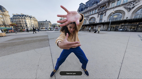
Hip-hop dancers show Paris in a new light on Street View
There's more we can help you with.
Check out some related products below
Street View
Explore world landmarks, discover natural wonders, and step inside places with Street View on Google Maps
Google Earth
Explore worldwide satellite imagery, 3D buildings, and terrain for hundreds of cities with Google Earth
Local Guides
Become a Local Guide to help people everywhere find the places worth seeing and things worth doing
Google My Business
Stand out to people searching on Google, and connect with customers with a free business profile
Get Google Maps
Google Maps 4+
Places, navigation & traffic.
- #1 in Navigation
- 4.7 • 5.8M Ratings
Screenshots
Description.
Navigate your world faster and easier with Google Maps. Over 220 countries and territories mapped and hundreds of millions of businesses and places on the map. Get real-time GPS navigation, traffic, and transit info, and find what you need by getting the latest information on businesses, including grocery stores, pharmacies and other important places. Get where you need to go efficiently: • Find the best route with automatic rerouting based on live traffic, incidents, and road closure Find important businesses: • Know what’s open in your area and their latest business hours • Find local restaurants offering delivery and takeout • Create lists of your important places Get there faster with real-time updates • Beat traffic with real-time ETAs and traffic conditions • Catch your bus, train, or ride-share with real-time transit info • Save time with automatic rerouting based on live traffic, incidents, and road closure • With Live View in Google Maps, see the way you need to go with arrows and directions placed right on top of your world. There’s no second guessing or missing another turn. More experiences on Google Maps • Offline maps to search and navigate without an internet connection • Street View and indoor imagery for restaurants, shops, museums and more • Indoor maps to quickly find your way inside big places like airports, malls and stadiums Some features not available in all countries Navigation isn't intended to be used by oversized or emergency vehicles
Version 6.108.1
Thanks for using Google Maps! This release brings bug fixes that improve our product to help you discover new places and navigate to them.
Ratings and Reviews
5.8M Ratings
THE UPDATE IS HORRIBLE!!
In the recent past if I wanted to go to a specific location all I had to do was open up my browser, hit the directions button, and the Google Maps app would open and take me right there. Now when I go through that same process an alternative screen comes up, but you can’t see all of the options when you’re driving so you pull over and you’re still fumbling your way through the process with extended steps to maneuver through it and ultimately wants you to open up the Google Maps app, but by the time you get there the address is completely gone and won’t transfer over to the app. This app is completely useless because it will not allow you to navigate anywhere with directions now. I’ve done all of the updates, but to no avail does this app work. I’m sure I’m not the only person to complain about this, but at this point, I’m going to have to completely delete the Google Maps app and go with an alternative solution. Google Maps has one job to do. Why did you have to mess up what was already working? Now your app is non-functional.
Don’t guys rely on google maps app. I am using it for years without any complaints. But today, google maps made my day as a nightmare. We went to Grand Canyon by car from Las Vegas. It’s was alright and took us about 4 and half hours, but when we were going back it’s showed me two routes 7 and 8 hours. I was confused because we only drove 4… but I was completely sure everything will be alright, that’s my buddy google maps I can rely on. And then… it took us in the middle of nowhere inside of different canyon with all forests and deserts everywhere and then it was a turn on some kind of road wHICH IS NOT ROAD AT ALL. Even horse can’t pass it. We stacked into the mud or grease and all of us didn’t have ANY SIGNAL TO CALL FOR HELP. It was 3 adults and 2 kids. We spent hours there pushing cars back to normal road. We got so much stress, fear, hopeless. I was like: “it can’t be true..” And then we figure out how to get back on free way and I open my app again, I though that it’s ok if that time it’s confused but when google maps see us on highway driving in right direction it will restart and finally works! But no… it tried to take us back to the woods. The road there even called “lost canyon road” so I just want to say that google maps isn’t always right and it’s not an app you can be sure about. You guys better fix this, we saw couple people going there back and force and even stacked like us with no signal. Thanks for attention, but I am still pretty upset.
Cycling Maps feature unnecessarily falls short
Map doesn’t display on screen when I’m using step by step navigation but it does when you’re driving. So you can’t see where you’re going…you get notifications on your screen for each direction instead, something you have to try to read and pedal and steer simultaneously, unless you enjoy stopping to see what your next direction is after every single one you complete. That’s the other thing, it gives you directions literally the moment you need them. When you drive, if it says go left, you turn left and it tells you your next street and turn to look for and the distance before you reach it. In cycling mode, in the same scenario, it would say turn left as you reached the street and continue to say turn left until you reach your next turn. So you have no idea at all what to look for, can’t anticipate anything, and you’re basically riding blind between each step. And if you miss a step, it automatically re routes you, so I rode about three miles uphill needlessly in the rain yesterday because I couldn’t hear my phone over the road and rain noise, nor had any idea what turn to look for, when to look for it, or how to rectify all of those failures in real time, I was pretty much being led astray in the pouring rain by an app that doesn’t have any of these problems in driving mode…

App Privacy
The developer, Google , indicated that the app’s privacy practices may include handling of data as described below. For more information, see the developer’s privacy policy .
Data Linked to You
The following data may be collected and linked to your identity:
- Financial Info
- Contact Info
- User Content
- Search History
- Browsing History
- Identifiers
- Diagnostics
Privacy practices may vary, for example, based on the features you use or your age. Learn More
Information
English, Albanian, Arabic, Armenian, Azerbaijani, Burmese, Catalan, Croatian, Czech, Danish, Dutch, Finnish, French, Georgian, German, Greek, Hebrew, Hindi, Hungarian, Indonesian, Italian, Japanese, Korean, Lithuanian, Malay, Norwegian Bokmål, Polish, Portuguese, Romanian, Russian, Serbian, Simplified Chinese, Slovak, Spanish, Swahili, Swedish, Thai, Traditional Chinese, Turkish, Ukrainian, Uzbek, Vietnamese
- Developer Website
- App Support
- Privacy Policy
More By This Developer
YouTube: Watch, Listen, Stream
Gmail - Email by Google
Google Chrome
Google Drive
Google Docs: Sync, Edit, Share
You Might Also Like
Waze Navigation & Live Traffic
Moovit: All Transit Options
Uber - Request a ride
GPS Live Navigation
Sygic GPS Navigation & Maps
MAPS.ME: Offline Maps, GPS Nav
Google Earth
Create stories and maps.
With creation tools, you can draw on the map, add your photos and videos, customize your view, and share and collaborate with others.
Create on Earth
Draw on the map.
Add placemarks to highlight key locations in your project, or draw lines and shapes directly on the map.
Add your photos and videos
Feature images and videos on your map to add rich contextual information.
Customize your view
Make use of Google Earth's detailed globe by tilting the map to save a perfect 3D view or diving into Street View for a 360 experience.
Share your story with the world
Collaborate with others like a Google Doc and share your story as a presentation.
- Help Center
- Google Maps
- Privacy Policy
- Terms of Service
- Submit feedback
Get directions & show routes
You can get directions for driving, public transit, walking, ride sharing, cycling, flight, or motorcycle on Google Maps. If there are multiple routes, the best route to your destination is blue, all other routes are gray. Some directions in Google Maps are in development and may have limited availability.
Important: Stay alert when you use directions on Google Maps. Always be aware of your surroundings to ensure the safety of yourself and others. When in doubt, follow actual traffic regulations and confirm signage from the road or path that you’re on.
- On your computer, open Google Maps .
- Click points on the map, type an address, or add a place name.
Tip: To choose another route in any transportation mode, select it on the map. Each route shows the estimated travel time on the map.
Google Maps transportation modes
You can get directions for different modes of transportation in Google Maps. Learn about the differences in features and availability between each mode:
- If you want to change a driving route, click and hold a spot on the route and drag it to a new spot on the map.
- Not all cities have public transit directions in Google Maps. Before you can get transit directions, your local transit agency needs to add their route info to Google Maps.
- If you want directions in an area with ride or taxi services, you can compare ride services with transit and walking directions. Learn how to request a ride .
- Directions to multiple destinations, or waypoints, aren’t available for public transit or flight searches.
- Learn more about how to search for flights .
- Learn how to get directions for motorcycles .
Add multiple destinations
You can get directions to multiple destinations for all modes of transportation except public transit or flight.
- Add a starting point and a destination.
- You can add up to 9 stops.
- Click on a route to get the directions.
Tip : You can search for places along your route.
To change the order of your stops:
- Find the destination you want to move.
- Drag the destination.
Preview directions in Street View
- On your computer, under the route you want, click Details.
- Point to a step in the directions. If Street View is available, you get a preview photo.
- To get Street View for other steps in the route, in the bottom-left box, click Previous step or Next step.
Customize your route
- Choose Options .
- Check the box next to "Tolls" or "Highways."
- Get directions.
- After you get your directions, click Leave now .
- To change your travel dates or times, select Depart at or Arrive by .
When you enter a destination in Google Maps, we show you how to get there using different travel modes, like driving, cycling, or walking.
Sometimes, the transport options we show you are ranked according to a combination of objective factors designed to help you find relevant and useful information. These factors can include duration, distance, price, your mode preference, or the relevance of a mode to your query. Generally, the most important factors are your mode preference, trip durations, and sometimes price.
Where available, we also show you other mobility services like public transport, scooter or bicycle rentals, and vehicle ride services. These mobility services are provided by third parties who have made their transport data publicly available or who have a partner agreement with us. Any partnerships or business relationships we may have with any transportation service providers do not influence the ranking of these services.
Related resources
- Get traffic or search for places along the way
- Plan your commute or trip
Was this helpful?
Need more help, try these next steps:.
Download Now
Explore Google Earth
Grab the helm and go on an adventure in Google Earth.
- Route planner
Top 5 Most Beautiful MTB Trails in Eyach-Und Rotenbachtal
Eyach-Und Rotenbachtal
MTB Trails in Eyach-Und Rotenbachtal
Looking for the best mountain biking routes in Eyach-Und Rotenbachtal? Then browse our collection of mtb rides around this beautiful natural park around Calw below — and discover more of on your next visit.
Plan. Save. Navigate. Your best adventures await.
Start today with a free komoot account.
Kapfenhardter Mühle – Schloss Neuenbürg loop from Neuenbürg (Württ.) Eyachbrücke
Super aussicht – herrliche aussicht loop from rotenbach (enz).

Let us show you the way with the komoot mobile app
Aussichtsturm schwanner warte – aussicht loop from neuenbürg (württ.) eyachbrücke, ettlingen – epplesee forchheim loop from neuenbürg (württ.) freibad, trinkbrunnen auf dem weg – enzbrücke loop from neuenbürg (württ.) eyachbrücke.
Our Tour recommendations are based on thousands of activities completed by other people on komoot.
Popular around Eyach-Und Rotenbachtal
Bike Touring Collection by komoot
Road Cycling Collection by komoot
Running Collection by komoot
Mountain Climbing Collection by komoot
Find the perfect Tour
Explore the most popular tours in eyach-und rotenbachtal, discover the most popular attractions in eyach-und rotenbachtal.
Explore more of Calw : Browse the best MTB Trails in other regions.
- Bad Wildbad
- Bad Herrenalb
- Würm-Heckengäu
- Althengstett
- Wildseemoor (Bannwald)
- Enzklösterle
- Unterreichenbach
- Bad Liebenzell
- Höfen an der Enz
- Hesel-, Brand- Und Kohlmisse
- Simmersfeld
- Winterhalde
- Bad Teinach-Zavelstein
Create your own custom map
- Make a map of the World, Europe, United States, and more
- Color code countries or states on the map
- Add a legend and download as an image file
- Use the map in your project or share it with your friends
- Free and easy to use
- Plus version for advanced features
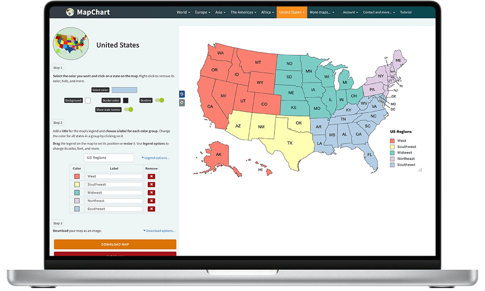
Color an editable map
- Europe, Africa, the Americas, Asia, Oceania
- US states and counties
- Subdivision maps (counties, provinces, etc.)
- Single country maps (the UK, Italy, France, Germany, Spain and 20+ more)
- Fantasy maps
- Get your message across with a professional-looking map .
- Download your map as a high-quality image , and use it for free .
Get your map in 3 simple steps
- Click on any country/state on the map to color it.
- Fill out the legend with descriptions for each color group.
- Select Download map to download your map as an image.
Fully customize your free map
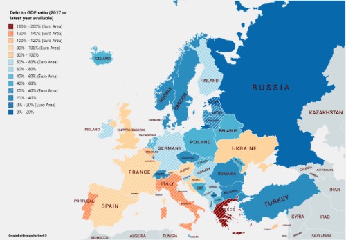
- Use the color scheme you want for your map.
- Suitable colors for statistical and choropleth maps.
- Colorblind-friendly palettes.
- Use patterns (dots, stripes, lines, etc.) for countries/states that belong in two groups.
- Change background color, borders, legend font, legend color and give your map your own styling.
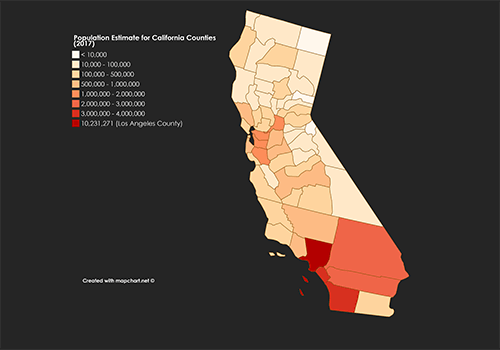
- Get a high-resolution image of your map for free.
- Hide any country/state you don't need on the map.
- Use Zoom Mode to zoom in and focus on a specific map area.
- Resize and move the map's legend around.
- Save your work and continue your map later.
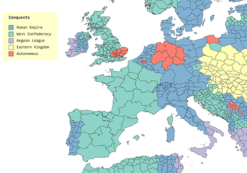
- Use the Detailed maps that show all first-level subdivisions of countries.
- Isolate countries and states.
- Color all subdivisions of a country with one click.
- Great for making alternate history scenarios.
- Import data from Excel on selected maps.
The #1 map-making website, used daily in:
- Scientific papers
- Geography AP courses
- Market research
- Sales presentations
- Infographics
- Landing pages
- Statistical surveys
- Alternate history
- Travel maps
- Cartography
- and more...
Check out the Showcase for more examples.
Ready? Select the map you want to create from below
For historical maps please visit Historical MapChart .
With Microstates
Subdivisions
United States
USA and Canada
The Americas
United Kingdom / Ireland
Historic Counties
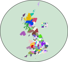
Election Map (UK only)
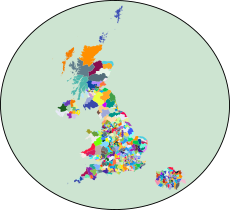
Postcodes (UK only)
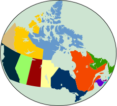
Provinces/Terr.
Census Divisions
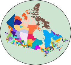
Election Map
Departments
Municipalities
Netherlands
The Caribbean
Middle East
War Games World map
Europa Universalis IV
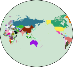
Pacific-centered World
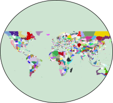
Hearts of Iron IV

IMAGES
VIDEO
COMMENTS
Find local businesses, view maps and get driving directions in Google Maps.
This map shows the forecasted average atmospheric pressure at sea level. Low-pressure areas often bring cloudy and windy weather. High-pressure areas are associated with clear skies and lighter winds. OK. ICON Forecast Model. ICON is a forecast model run by Germany's weather service DWD.
Eyachtal - von der Forellenzucht bis hin zur Eyachmühle. 19. Haus am Brotenaubach. 20. Mißlesgrundbrunnen. Read More. The top 20 Attractions in Eyach-Und Rotenbachtal. 1. ... Map of the Top 20 in Eyach-Und Rotenbachtal. Last updated: November 28, 2023. Popular around Eyach-Und Rotenbachtal.
Von allen Bus-Haltestellen in Dobel (Höhe) bietet sich eine Wanderung ins Eyachtal (4 km) zum Startpunkt an. Die Dobler Bushaltestellen werden von den Linien 716, 719 und X63 angefahren. Anfahrt. Auf der L340 von Bad Herrenalb oder von Straubenhardt/Enztal kommend bis Dobel. Weiter über die Ortsverbindungsstraße von Dobel (Höhe) nach Dobel ...
About this app. Navigate your world faster and easier with Google Maps. Over 220 countries and territories mapped and hundreds of millions of businesses and places on the map. Get real-time GPS navigation, traffic, and transit info, and explore local neighborhoods by knowing where to eat, drink and go - no matter what part of the world you're in.
Whether you need to plan a road trip, a commute, or a walk, MapQuest Directions can help you find the best route. You can customize your journey with multiple stops, avoid tolls and highways, and get live traffic and road conditions. You can also discover nearby attractions, restaurants and hotels with MapQuest Directions.
Official MapQuest website, find driving directions, maps, live traffic updates and road conditions. Find nearby businesses, restaurants and hotels. Explore!
Find the best route when driving, with real-time updates on traffic jams, accidents, road closures and speed traps. You can also keep fellow drivers in the know by reporting incidents yourself. Hands-free help with the Google Assistant. Your Google Assistant is now integrated into Google Maps so you can message, call, listen to music and get ...
Use your phone to add places, images, and videos to your maps. Then, pick it up from your browser later. Tell your story. Showcase an interactive slideshow of your project.
Get there faster with real-time updates. • Beat traffic with real-time ETAs and traffic conditions. • Catch your bus, train, or ride-share with real-time transit info. • Save time with automatic rerouting based on live traffic, incidents, and road closure. • With Live View in Google Maps, see the way you need to go with arrows and ...
Dobel, Eyachtal, Grünhütte. 16. Juli 2017. Edgar_HFJ. Sehr schöne kurze Tour mit sehr leckerem Essen in der Eyachmühle. 18. November 2017. iDrops. Eigentlich ein gut gelegenes Gasthaus mit vermutlich leckerem Essen. Leider werden wir das nie erfahren, denn nach längerer Wartezeit wurde unsere Bestellung nicht aufgenommen, stattdessen ...
Eyachtal / entlang der Eyach - alter Wasserturm loop from Pforzheim Hauptbahnhof. 02:37. 52.7 km. 600 m. Intermediate. 14. Richtung Eyachtal - Eyachtal / entlang der Eyach loop from Calmbach. 01:40. 29.7 km. 320 m. Expert. 21. Radweg durchs Murgtal - Eyachtal / entlang der Eyach loop from Etzenrot. 07:11. 143 km. 2,140 m.
Official MapQuest is your online guide for maps, driving directions, and live traffic. Explore the world, find the best routes, and save time and money. Visit mapquest.com and get started.
Understand Google Maps app features. To help you access features faster, Google Maps app has been updated. When you open the Google Maps app, you can find 5 tabs at the bottom of the Home Screen: Explore : Choose where to go. Go: What to expect along your frequent trips. Saved : Create lists and recall places.
Create stories and maps. With creation tools, you can draw on the map, add your photos and videos, customize your view, and share and collaborate with others. Create on Earth.
On your computer, open Google Maps. Click Directions . Add a starting point and a destination. On the left, below the destinations you entered, click Add . To add a stop, choose another destination. You can add up to 9 stops. Click on a route to get the directions. Tip: You can search for places along your route.
Map multiple locations, get transit/walking/driving directions, view live traffic conditions, plan trips, view satellite, aerial and street side imagery. Do more with Bing Maps.
Das Naturschutzgebiet besteht aus den Teilgebieten Eyachtal und Rotenbachtal. Das Gebiet Eyachtal liegt zwischen Dobel im Norden und Bad Wildbad im Süden und umfasst die Talaue der Eyach von den Quellbächen bis zur Einmündung in die Enz. Das Gebiet Rotenbachtal liegt südöstlich von Straubenhardt und umfasst die Talaue des Rotenbaches von ...
Grab the helm and go on an adventure in Google Earth.
Naturschutzgebiet Eyachtal - Kaiser Wilhelm Turm loop from Dobel. Intermediate. 02:59. 34.4 km. 11.5 km/h. 630 m. 630 m. Intermediate mountain bike ride. Good fitness required. ... Map of the 20 top MTB rides in Eyach-Und Rotenbachtal. Discover More Tours around Eyach-Und Rotenbachtal.
Subdivision maps (counties, provinces, etc.) Single country maps (the UK, Italy, France, Germany, Spain and 20+ more) Fantasy maps; Get your message across with a professional-looking map. Download your map as a high-quality image, and use it for free. Created maps are licensed under a Creative Commons Attribution-ShareAlike 4.0 International ...